

Being a weather forecaster is the only profession where you can be wrong half the time and still keep your job. That old joke may be true, but every boater knows getting caught in a storm is no laughing matter.
Next to putting fuel in the boat, checking the weather forecast before you head out on the water is about the most crucial task to check off your to-do list. Today’s weather apps make it much easier to stay up to date with the latest forecast, but even with all the weather models and satellite radar images out there, unforecasted storms still pop up on a regular basis, especially in the summer months when water and air temps are at their peak.
Marine weather changes in real time. Squalls develop quickly. Winds can gust seemingly out of thin air. Boaters should learn to recognize cloud changes and shifting sky colors that may signal approaching severe weather Knowing when to get out of dodge is one of the key factors to staying out of harm’s way. I’d rather cut the day short then get caught in a full-on downpour where you can hardly see a few feet in front of the bow of the boat.
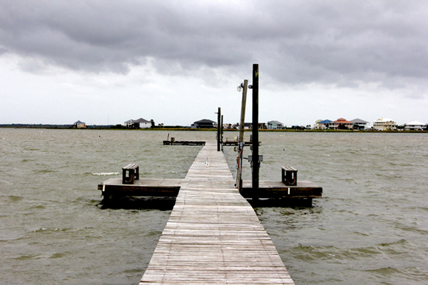
The Forecast Isn’t the Whole Story
A morning marine forecast is a snapshot, not a guarantee. Conditions on open water can shift faster than inland weather, especially near coastlines, inlets, and large lakes where local effects like sea breezes, thermal cycles, trade winds and winds funneling through channels surrounded by islands create microclimates that a general forecast won’t fully capture.
Treat the forecast as a starting point, not the final word. Once you’re underway, watching the sky, noticing changes in the wind direction, and understanding how building swells and shorter wave periods (the time in between waves) all signal impending bad weather.
You don’t need a meteorology degree to understand some basics about the different types of clouds. A few common cloud types can provide useful indications of changing weather. Cloud observations should supplement, not replace, marine forecasts, radar, weather alerts, and sound judgment.
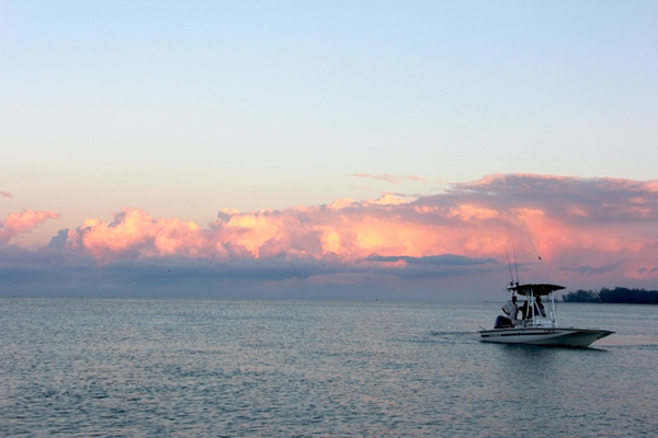
Always watch towering cumulus clouds closely. These start as puffy, cotton-ball formations, but if they begin building vertically, stacking upward with a hardening, cauliflower-like top, then they’re developing into thunderstorms. The taller and darker the base gets, the sooner you should turn around and head in, or at the very least, change course.
Clouds with anvil-shaped, wide tops are a clear sign that a storm has matured. When the tops of the clouds flatten out and spread, that means the storm has reached the upper atmosphere. These are now a fully formed thunderstorm cell, capable of lightning, wind gusts, and sudden downpours. If you see an anvil, treat it as a countdown. The weather is going to turn quickly. You should do the same and run back to safety.
A darkening horizon with a distinct shelf or cloud band that looks like it’s rolling toward you often signals an approaching squall line. These can bring sudden, sharp wind shifts and gusts well ahead of any visible rain. Squall lines are deceptive because they can look distant one minute and be on top of you the next.
Wispy, streaked feather-shaped cirrus clouds followed by rippled, patchy cloud cover are classic signs that the weather will change over the next 12 to 24 hours. These are not an immediate threat, but they’re worth noting, especially if you’re planning a long crossing or multi-day trip. They often signal an impending wind change or increase in wind speed.
Water spouts are another phenomenon that you need to steer clear of. These form under developing cumulus clouds in calm, humid conditions in warm-water areas like the Florida Keys. They are typically not caused by severe thunderstorms. They are fascinating to watch, but they pack a very localized, focused punch. Steer clear.
Trust your instincts. If the horizon turns hazy or visibility diminishes, something is afoot. Slow down, reassess and make a new plan.
Motor Ahead or Turn Back?
There’s no perfect formula, but a few practical steps can help with the decision of either continuing on, or turning around.
Use Your Onboard Electronics
Your eyes and instincts are the first line of defense, but if your boat is equipped with onboard radar and satellite weather, use those tools to monitor conditions that you can’t see on the horizon.
Onboard marine radar is one of the most valuable tools for storm tracking, especially offshore or in low-visibility or nighttime conditions when you can’t see the clouds. Haze, fog, and low-light times of day make reading the skies impossible.
Marine radars can detect precipitation density and storm clouds, which show up as returns on your display. A tight, dense cluster of returns building quickly is a strong sign of a developing storm cell, while a broad, lighter return often indicates steady, less severe rain. Many units also let you overlay storm movement over a few sweeps, giving you a rough sense of speed and direction which is critical information for deciding whether to press on, adjust course, or head for shelter. Radar is also one of the few tools that works just as well at 2 a.m. as it does at high noon.
Satellite-delivered marine weather services can provide weather data to a compatible onboard display via satellite. This can be useful for offshore crews that travel beyond cell coverage. Once you’re miles offshore, cell service may be unavailable, while a compatible, properly equipped chartplotter may continue receiving radar imagery, storm-cell tracking, lightning-strike data, wind and wave forecasts, and NOAA-issued marine warnings, depending on the service, equipment, subscription, and conditions. These services can provide additional information when evaluating weather conditions, but they should not be relied on as a substitute for official forecasts and warnings or the operator’s judgment.
Used together, onboard radar and satellite-delivered marine weather services can provide information about nearby precipitation and broader weather conditions.
Mother Nature Always Wins
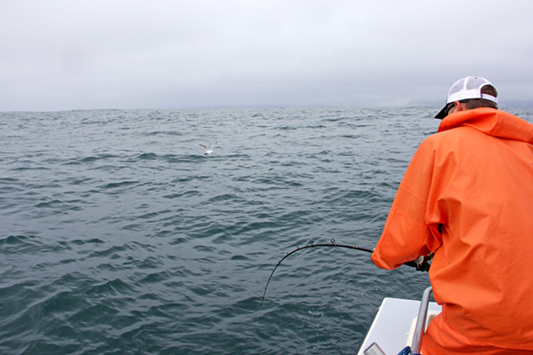
Even boats with satellite connectivity and powerful radar on board can still get caught in a storm. When this happens, take prompt action based on the conditions, official guidance, and the vessel’s operating instructions. Get out the foul-weather gear, including a waterproof jacket, bibs or pants and, if you have them, rubber deck boots. You should already be wearing a properly fitted and secured PFD, but if you’re not, put one on and secure it in accordance with its instructions.
Back to Blue Life
Next to putting fuel in the boat, checking the weather forecast before you head out on the water is about the most crucial task to check off your to-do list. Today’s weather apps make it much easier to stay up to date with the latest forecast, but even with all the weather models and satellite radar images out there, unforecasted storms still pop up on a regular basis, especially in the summer months when water and air temps are at their peak.
Marine weather changes in real time. Squalls develop quickly. Winds can gust seemingly out of thin air. Boaters should learn to recognize cloud changes and shifting sky colors that may signal approaching severe weather Knowing when to get out of dodge is one of the key factors to staying out of harm’s way. I’d rather cut the day short then get caught in a full-on downpour where you can hardly see a few feet in front of the bow of the boat.
The Forecast Isn’t the Whole Story
A morning marine forecast is a snapshot, not a guarantee. Conditions on open water can shift faster than inland weather, especially near coastlines, inlets, and large lakes where local effects like sea breezes, thermal cycles, trade winds and winds funneling through channels surrounded by islands create microclimates that a general forecast won’t fully capture.
Treat the forecast as a starting point, not the final word. Once you’re underway, watching the sky, noticing changes in the wind direction, and understanding how building swells and shorter wave periods (the time in between waves) all signal impending bad weather.
You don’t need a meteorology degree to understand some basics about the different types of clouds. A few common cloud types can provide useful indications of changing weather. Cloud observations should supplement, not replace, marine forecasts, radar, weather alerts, and sound judgment.
Always watch towering cumulus clouds closely. These start as puffy, cotton-ball formations, but if they begin building vertically, stacking upward with a hardening, cauliflower-like top, then they’re developing into thunderstorms. The taller and darker the base gets, the sooner you should turn around and head in, or at the very least, change course.
Clouds with anvil-shaped, wide tops are a clear sign that a storm has matured. When the tops of the clouds flatten out and spread, that means the storm has reached the upper atmosphere. These are now a fully formed thunderstorm cell, capable of lightning, wind gusts, and sudden downpours. If you see an anvil, treat it as a countdown. The weather is going to turn quickly. You should do the same and run back to safety.
A darkening horizon with a distinct shelf or cloud band that looks like it’s rolling toward you often signals an approaching squall line. These can bring sudden, sharp wind shifts and gusts well ahead of any visible rain. Squall lines are deceptive because they can look distant one minute and be on top of you the next.
Wispy, streaked feather-shaped cirrus clouds followed by rippled, patchy cloud cover are classic signs that the weather will change over the next 12 to 24 hours. These are not an immediate threat, but they’re worth noting, especially if you’re planning a long crossing or multi-day trip. They often signal an impending wind change or increase in wind speed.
Water spouts are another phenomenon that you need to steer clear of. These form under developing cumulus clouds in calm, humid conditions in warm-water areas like the Florida Keys. They are typically not caused by severe thunderstorms. They are fascinating to watch, but they pack a very localized, focused punch. Steer clear.
Trust your instincts. If the horizon turns hazy or visibility diminishes, something is afoot. Slow down, reassess and make a new plan.
Motor Ahead or Turn Back?
There’s no perfect formula, but a few practical steps can help with the decision of either continuing on, or turning around.
- Know Before You Go. Check the NOAA forecast before you leave the dock and check again before you find yourself outside of cell coverage. Pull up a satellite radar image of the weather on your phone that shows storm cells and lightning strikes. Note the movement to give you an idea of which direction any potential weather is headed.
- Pay Attention to Wind Direction, Not Just Clouds. A sudden wind shift or a noticeable temperature drop often arrives before visible storm clouds. If the air temp drops quickly enough to notice and the wind starts picking up, take that as a warning from the weather gods.
- Give Yourself a Buffer. If a storm looks like it’s 45 minutes out, assume you have half that time to change plans. Storms over water move faster than they appear, and there’s no exit ramp to pull off when you’re on the water.
- Find the Closest Safe Harbor. When you plan a course, note the closest harbors along the route, not just your final destination. If the weather turns, your first move should be to run to the nearest safe point, not necessarily heading all the way back to where you launched.
- When In Doubt, Don’t Go. It’s a simple rule, but it always holds up. Cutting a trip short is an inconvenience or a bummer. Trying to navigate a boat caught in a fast-moving storm is genuinely scary. If you have reservations, just stay home and use the day to get a few maintenance items done on the boat.
Use Your Onboard Electronics
Your eyes and instincts are the first line of defense, but if your boat is equipped with onboard radar and satellite weather, use those tools to monitor conditions that you can’t see on the horizon.
Onboard marine radar is one of the most valuable tools for storm tracking, especially offshore or in low-visibility or nighttime conditions when you can’t see the clouds. Haze, fog, and low-light times of day make reading the skies impossible.
Marine radars can detect precipitation density and storm clouds, which show up as returns on your display. A tight, dense cluster of returns building quickly is a strong sign of a developing storm cell, while a broad, lighter return often indicates steady, less severe rain. Many units also let you overlay storm movement over a few sweeps, giving you a rough sense of speed and direction which is critical information for deciding whether to press on, adjust course, or head for shelter. Radar is also one of the few tools that works just as well at 2 a.m. as it does at high noon.
Satellite-delivered marine weather services can provide weather data to a compatible onboard display via satellite. This can be useful for offshore crews that travel beyond cell coverage. Once you’re miles offshore, cell service may be unavailable, while a compatible, properly equipped chartplotter may continue receiving radar imagery, storm-cell tracking, lightning-strike data, wind and wave forecasts, and NOAA-issued marine warnings, depending on the service, equipment, subscription, and conditions. These services can provide additional information when evaluating weather conditions, but they should not be relied on as a substitute for official forecasts and warnings or the operator’s judgment.
Used together, onboard radar and satellite-delivered marine weather services can provide information about nearby precipitation and broader weather conditions.
Mother Nature Always Wins
Even boats with satellite connectivity and powerful radar on board can still get caught in a storm. When this happens, take prompt action based on the conditions, official guidance, and the vessel’s operating instructions. Get out the foul-weather gear, including a waterproof jacket, bibs or pants and, if you have them, rubber deck boots. You should already be wearing a properly fitted and secured PFD, but if you’re not, put one on and secure it in accordance with its instructions.
Back to Blue Life