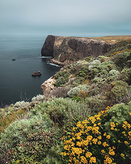
California boasts eclectic, sometimes astoundingly eccentric, lifestyles and experiences, but it also harbors highly unique natural resources. The wild and mountainous Channel Islands National Park, touted as the “Galapagos of North America,” starts just 11 miles off the coast and features spectacular biodiversity with many plant and animal species found nowhere else.
Located at the confluence of two major ocean currents, this junction also delivers weather that can be as wild as its native wildlife — making its exploration by boaters somewhat daring.
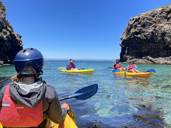
“This is a major visually stunning area with sheer cliffs that fall into the sea,” says Capt. David Bacon, a seasoned charter guide and boating-safety consultant out of Santa Barbara. “But what makes the area interesting and challenging is the weather, no matter if we’re talking about storms or normal wind patterns.”
This peculiar vortex forms because of California’s coastline, which first drops to the south and slightly east from Oregon to Point Conception, and then takes a dramatic right turn, scooping into the landmass that is Southern California. This region, referred to as a bight a bend or indentation in a coastline, homes the Channel Islands chain, comprising the five northern national park islands off Santa Barbara and Ventura, as well as Santa Catalina, San Clemente and San Nicolas well south, off of Los Angeles.
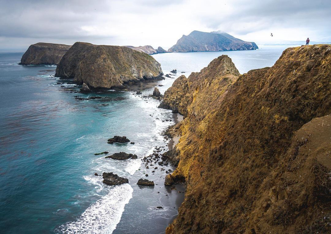
“Winds come south down the coast, and when they get to Point Conception, they refract around the point. That creates a turning motion of the wind that draws the south wind in and the air is sucked from west to east through the Santa Barbara Channel,” Bacon explains. “We get days when the water is glassy and smooth, and you could take any boat out there. But the variable nature of the winds and seas of the channel make crossing, especially coming home in the afternoon, not for the faint of heart or small of boat.”
Fall offers the longest periods of calm weather for boaters, many of whom opt to visit the most proximate park island, Anacapa, about 11 miles off Ventura. From there, the next three islands extend to the west. It’s just a quick run from Anacapa to the 20-mile-long Santa Cruz Island, where you’ll find the renowned Painted Cave — at 1,227 feet long, one of the largest sea caves in the world.
But, if your boat is capable and you have time, venturing to the third island, Santa Rosa, or the fourth, San Miguel, can open new worlds. “Going out to Santa Rosa is a magical experience,” Bacon says. “If the weather lets you out, San Miguel is a mystical experience. It’s much less frequented.”
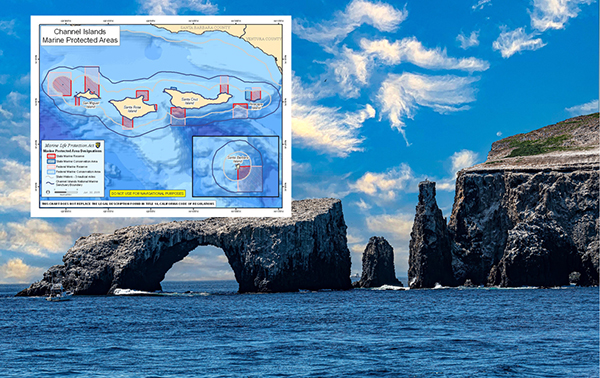
Thankfully, fishing these islands excels year-round. Rocky substrate with relief attracts calico bass and rockfish. White seabass and California halibut also make the islands home. The peak season for halibut falls between May and October; the best seabass fishing happens during the squid spawn, usually signaled by the commercial fishing fleet.
Fishing varies between the north and south sides of the park islands. On the north side, the water can be 10 degrees colder as the chillier current sweeps through. The south side of the island sees warmer waters flowing from the south. Here yellowtail come up during summer and early fall; dorado gather around the current breaks where they intersect with kelp paddies. And at times, yellowfin tuna will ride in on an El Niño current. Divers explore, even spearfish, the sun-dappled kelp forests. The north side of Santa Cruz is a great place to see California’s official saltwater fish, the bright-orange garibaldi, Bacon says. Water temperatures can range from the 50s to the low 70s.
.jpg)
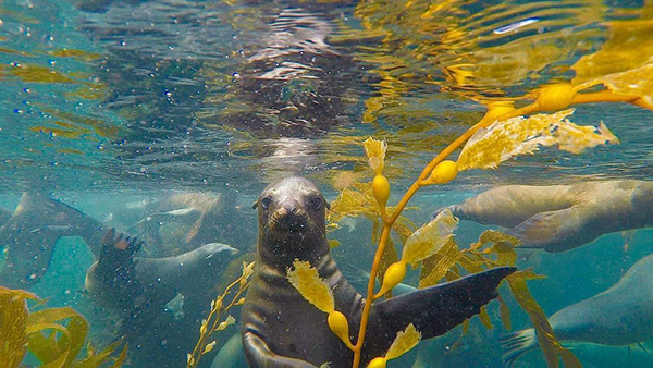
Sea lions and seals hunt throughout the islands. San Miguel hosts a major rookery for the protected elephant seal.
Gray whales migrate south through the Santa Barbara Channel to Baja California in the early part of winter, returning north in late winter and early spring. Some choose to shoot the gaps between islands; watch for them between Santa Cruz and Santa Rosa in late March or early April, Bacon advises.
Humpback whales travel the region throughout the year, and in summer, look for gigantic blue whales. At 75 to nearly 100 feet long, these behemoths are said to be the largest animals to ever live on our planet.
Don’t forget to look up, as well. Pelagic birds such as the red-billed tropicbird, least storm-petrel, Guadalupe murrelet and various boobies and shearwaters flock to these ecologically rich waters and remote landscapes. By the way, “remote” is no understatement when describing the Channel Islands National Park, particularly the 1-square-mile Santa Barbara Island, 42 miles south of Anacapa. You won’t find a fuel dock, grocery store, concessions, ground transportation, or even dependable cellular service on any of the islands, and the moorings are reserved for government personnel. However, there’s no fee to and by boat, and anchoring and camping are permitted.
If you prefer a better-appointed island, head south — or leave out of Long Beach — and visit Santa Catalina. Its main city, Avalon, offers premier restaurants and quaint hotels. San Clemente and San Nicolas are owned by the U.S. Navy; landing is prohibited.
The park service offers tips for boaters, including the best sources for weather information at http://nps.gov/chis/planyourvisit/boating. Before you go, properly equip your vessel with redundant safety gear, including EPIRBs and PLBs, and know your boat’s fuel needs. Bring extra clothing for the fickle weather, and in the event you must overnight aboard. File a Float Plan with someone back on the mainland, and cross in a flotilla or with a buddy boat, if possible.
“I look at all the weather resources and notice what the trends are, what the barometric pressure is doing, and I make my guesstimate,” Bacon says. “But Mother Nature is always going to surprise you.”
Back to Blue Life
Located at the confluence of two major ocean currents, this junction also delivers weather that can be as wild as its native wildlife — making its exploration by boaters somewhat daring.

“This is a major visually stunning area with sheer cliffs that fall into the sea,” says Capt. David Bacon, a seasoned charter guide and boating-safety consultant out of Santa Barbara. “But what makes the area interesting and challenging is the weather, no matter if we’re talking about storms or normal wind patterns.”
This peculiar vortex forms because of California’s coastline, which first drops to the south and slightly east from Oregon to Point Conception, and then takes a dramatic right turn, scooping into the landmass that is Southern California. This region, referred to as a bight a bend or indentation in a coastline, homes the Channel Islands chain, comprising the five northern national park islands off Santa Barbara and Ventura, as well as Santa Catalina, San Clemente and San Nicolas well south, off of Los Angeles.

“Winds come south down the coast, and when they get to Point Conception, they refract around the point. That creates a turning motion of the wind that draws the south wind in and the air is sucked from west to east through the Santa Barbara Channel,” Bacon explains. “We get days when the water is glassy and smooth, and you could take any boat out there. But the variable nature of the winds and seas of the channel make crossing, especially coming home in the afternoon, not for the faint of heart or small of boat.”
Fall offers the longest periods of calm weather for boaters, many of whom opt to visit the most proximate park island, Anacapa, about 11 miles off Ventura. From there, the next three islands extend to the west. It’s just a quick run from Anacapa to the 20-mile-long Santa Cruz Island, where you’ll find the renowned Painted Cave — at 1,227 feet long, one of the largest sea caves in the world.
But, if your boat is capable and you have time, venturing to the third island, Santa Rosa, or the fourth, San Miguel, can open new worlds. “Going out to Santa Rosa is a magical experience,” Bacon says. “If the weather lets you out, San Miguel is a mystical experience. It’s much less frequented.”

Thankfully, fishing these islands excels year-round. Rocky substrate with relief attracts calico bass and rockfish. White seabass and California halibut also make the islands home. The peak season for halibut falls between May and October; the best seabass fishing happens during the squid spawn, usually signaled by the commercial fishing fleet.
Fishing varies between the north and south sides of the park islands. On the north side, the water can be 10 degrees colder as the chillier current sweeps through. The south side of the island sees warmer waters flowing from the south. Here yellowtail come up during summer and early fall; dorado gather around the current breaks where they intersect with kelp paddies. And at times, yellowfin tuna will ride in on an El Niño current. Divers explore, even spearfish, the sun-dappled kelp forests. The north side of Santa Cruz is a great place to see California’s official saltwater fish, the bright-orange garibaldi, Bacon says. Water temperatures can range from the 50s to the low 70s.
.jpg)
Sea lions and seals hunt throughout the islands. San Miguel hosts a major rookery for the protected elephant seal.
Gray whales migrate south through the Santa Barbara Channel to Baja California in the early part of winter, returning north in late winter and early spring. Some choose to shoot the gaps between islands; watch for them between Santa Cruz and Santa Rosa in late March or early April, Bacon advises.
Humpback whales travel the region throughout the year, and in summer, look for gigantic blue whales. At 75 to nearly 100 feet long, these behemoths are said to be the largest animals to ever live on our planet.

Don’t forget to look up, as well. Pelagic birds such as the red-billed tropicbird, least storm-petrel, Guadalupe murrelet and various boobies and shearwaters flock to these ecologically rich waters and remote landscapes. By the way, “remote” is no understatement when describing the Channel Islands National Park, particularly the 1-square-mile Santa Barbara Island, 42 miles south of Anacapa. You won’t find a fuel dock, grocery store, concessions, ground transportation, or even dependable cellular service on any of the islands, and the moorings are reserved for government personnel. However, there’s no fee to and by boat, and anchoring and camping are permitted.
If you prefer a better-appointed island, head south — or leave out of Long Beach — and visit Santa Catalina. Its main city, Avalon, offers premier restaurants and quaint hotels. San Clemente and San Nicolas are owned by the U.S. Navy; landing is prohibited.
The park service offers tips for boaters, including the best sources for weather information at http://nps.gov/chis/planyourvisit/boating. Before you go, properly equip your vessel with redundant safety gear, including EPIRBs and PLBs, and know your boat’s fuel needs. Bring extra clothing for the fickle weather, and in the event you must overnight aboard. File a Float Plan with someone back on the mainland, and cross in a flotilla or with a buddy boat, if possible.
“I look at all the weather resources and notice what the trends are, what the barometric pressure is doing, and I make my guesstimate,” Bacon says. “But Mother Nature is always going to surprise you.”
Back to Blue Life
